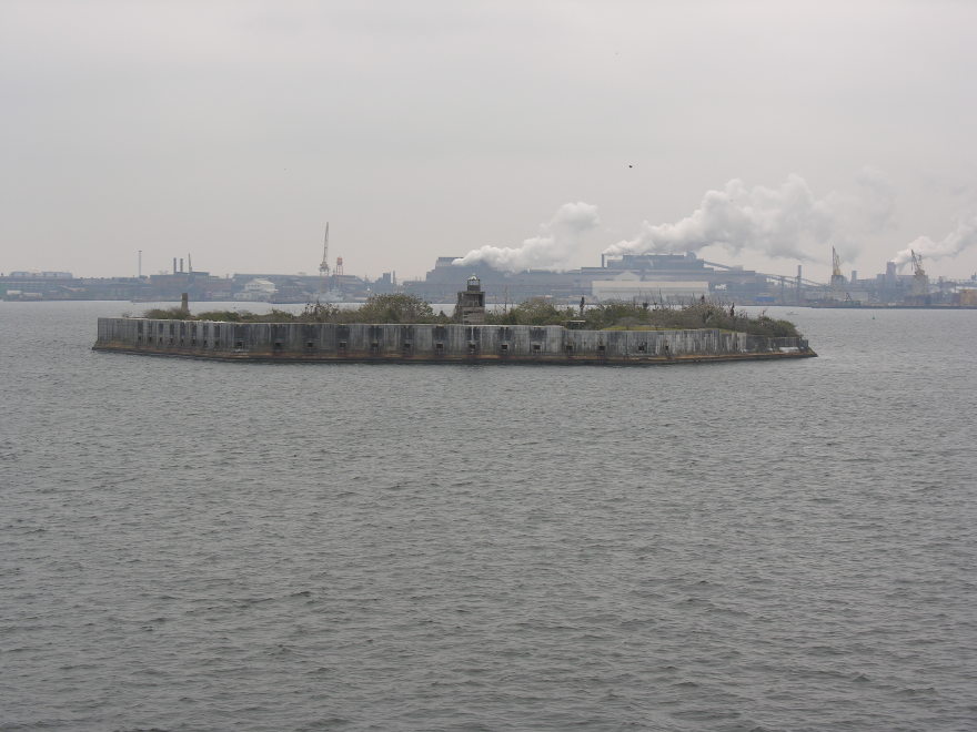
Free Picture: Baltimore Harbor Fort just outside Francis Scott Key Bridge
[Previous Page | Index | Next Page]
See All Free Photos

51_ss_john_w_brown_baltimore.jpg
[Previous Page | Index | Next Page]
See All Free Photos
Fort Carroll
Fort Carroll is a 3.4 acre (14,000 m²) artificial island and abandoned
fort in the middle of the Patapsco River, just south of Baltimore, Maryland.
The hexagonal structure was designed by then Brevet-Colonel Robert E.
Lee and named for Charles Carroll of Carrollton, a signer of the Declaration
of Independence. Construction of the fort began in 1848, under
Lee's supervision, by the U.S. Army Corps of Engineers. Fort Carroll
was important for the defense of Baltimore — before the fort
was created, the only military defensive structure between Baltimore
and the Chesapeake Bay was Fort McHenry.
The government abandoned the fort as a military post in 1920, and the
island was declared excess property in 1923. However, the War Department
took no immediate steps to sell the land. In May 1958, a Baltimore attorney
purchased the island for $10,000, but development plans never materialized.
The fort now is deserted. From Wikipedia, the free
encyclopedia)
This page last updated January 2015
Visit http://www.TechnologySite.org for free
photos and lists of inventions and technology. Visit http://www.ClimateChangeFacts.info for unbiased
information about climate change. Visit http://www.ClimateCooling.org for eye-opening
biased information on global cooling and climate change and visit http://www.OceanAssoc.com for fisheries
and oceans consulting services.