
OceansArt.US
|
Machu Picchu (In Quechua language means Old
Peak; sometimes called the "Lost City")
is a pre-Columbian city created by the Inca. It is located at 2,430 m (7,970
ft) on a mountain
ridge above the Urubamba Valley in Peru, about 70 km (44
mi) northwest of Cusco. Forgotten for centuries by the outside world, although
not by locals, it was brought back to international attention by archaeologist
Hiram Bingham who rediscovered it in 1911, 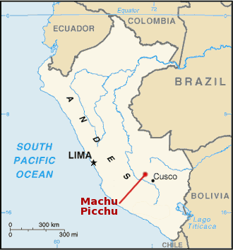 and wrote a best-selling work
about it. Peru is pursuing legal efforts to retrieve thousands of artifacts
that Bingham removed from the site.
Machu
Picchu is probably the most familiar symbol of the Inca Empire. Often referred
to as "The Lost City of the Incas", since 1983 the site
has been designated as a UNESCO World Heritage Site.
and wrote a best-selling work
about it. Peru is pursuing legal efforts to retrieve thousands of artifacts
that Bingham removed from the site.
Machu
Picchu is probably the most familiar symbol of the Inca Empire. Often referred
to as "The Lost City of the Incas", since 1983 the site
has been designated as a UNESCO World Heritage Site.
Machu Picchu was constructed around 1450,
at the height of the Inca empire, and was abandoned less than 100 years
later, as the empire collapsed under Spanish conquest. Although the citadel
is located only about 50 miles from Cusco, the Inca capital, it was never
found and destroyed by the Spanish, as were many other Inca sites. Over
the centuries, the surrounding jungle grew to enshroud the site, and few
knew of its existence. It wasn’t
until 1911 that Yale historian and explorer Hiram Bingham brought the “lost” city
to the world’s attention. Bingham and others hypothesized that the
citadel was the traditional birthplace of the Inca people or the spiritual
center of the “virgins of the sun,” while curators of a recent
exhibit have speculated that Machu Picchu was a royal retreat. Regardless,
the presence of numerous temples and ritual structures proves that Machu
Picchu held spiritual significance for the Inca. See the llamas of the Machu
Pichu Central Plaza interact in the movie.
It is thought that the site was chosen for its unique location and geological
features. It is said that the silhouette of the mountain range behind Machu
Picchu represents the face of the Inca looking upward
towards the sky, with
the largest peak, Huayna Picchu (meaning Young Peak), representing his pierced
nose. In 1913, the site received significant publicity after the National
Geographic Society devoted their entire April issue to Machu Picchu.
(Adapted from: Machu Picchu. (2007, June). From Wikipedia, The Free Encyclopedia.)
See all the free photos, including other photos of Peru by going to the Photo Catalog. Click on any picture for a FREE larger version. Read the licensing rules (REVISED) for your needs. There are hundreds of high quality free photos: use the Google/site search engine. See our digital photography tips : DOs and Don'ts; Choosing a Camera and Accessories , Downloading Photos, and Editing Photos. Visit TechnologySite.org for free photos and lists of inventions and technology and learn Climate Change Facts to see for yourself if your area is at risk from global warming or global cooling.
 01machupichu.jpg Machu Pichu in the morning mist before sunrise |
 02machupichu.jpg Machu Pichu in the morning mist before sunrise looking towards Huayna Pichu (Young Peak) |
|
 03machupichu.jpg Excellent stone work in temple area of Machu Picchu showing how the mountain is moving towards a collapse |
 05machupichu.jpg Looking down the Machu Picchu terraces |
|
 06machupichu.jpg Looking across the front face of Machu Picchu |
 07machupichu.jpg Excellent stone work in temple area of Machu Picchu |
|
 09machupichu.jpg Fine stonework in temple area of Machu Picchu |
 12machupichu.jpg Note cylindrical stone shafts for use in tying down roofs at Machu Picchu |
|
 14machupichumountainfailing.jpg Excellent stone work in temple area of Machu Picchu showing how the mountain is moving towards a collapse |
 15machupichu.jpg Looking down the terraces of Machu Picchu to the Urubamba River |
|
 16machupichusundial.jpg The Intihuatana ("tie the sun") is believed to have been designed as an astronomic clock by the Incas (Source: Wikipedia) |
 17machupichu.jpg Llamas can be found roaming over all of Machu Picchu. They crop the grass continuously and in many places humans and other animals cannot reach. |
|
 18machupichusquash.jpg Melon growing at Machu Picchu, probably one of the Inca cultivars |
 19machupichu.jpg Looking towards the front area of Machu Picchu |
|
 20amachupichucondormouthaltar.jpg Wings of condor at altar |
 20machupichucondormouthaltar.jpg Head of condor altar and sacrificial blood receptical |
|
 21machupichualtarpens.jpg Holding pens for sacrificial offerengs above altars in temple area of Machu Picchu |
 24machupichumirrormortar.jpg Water mirrors used to explore the night sky from the observatory |
|
 25machupichuclassicview.jpg View across Machu Picchu towards Huayna Picchu |
 26machupichualtar.jpg Altar at top of Machu Picchu |
|
 27machupichudooralignment.jpg View of Huayna Picchu from Machu Picchu looking through a trapezoidal doorway, typical of the design prowess of the Incas. |
 28machupichu.jpg Llamas can be found roaming over all of Machu Picchu. They crop the grass continuously and in many places humans and other animals cannot reach. |
|
 29machupichu.jpg Looking from Huayna Picchu towards Machu Picchu |
 30amachupichu.jpg Inside of reconstructed thatched roof of building at Machu Picchu |
|
 30machupichu.jpg Reconstructed thatched roof of building at Machu Picchu |
 31machupichu.jpg View looking down from Huayna Picchu away from MachuPicchu |
|
 32machupichuviewabove.jpg View looking down from Huayna Picchu to the whole of Machu Picchu |
 34machupichuriver.jpg View looking down from Huayna Picchu to the Urubamba River |
|
 35machupichuswitchbacks.jpg Machu Picchu seen from Huayna Picchu, showing the Hiram Bingham Highway used by buses taking tourists to and from the town of Aguas Calientes. |
 36machupichu.jpg Old building on Huayna Picchu. Clearly a large population lived at the top despite nearly impossible access. |
|
 37machupichukimsteps.jpg View looking down the steep steps from Huayna Picchu to Machu Picchu |
 39machupichulichen.jpg Lichen on side of Huayna Picchu mountain |
|
 40machupichuorchid.jpg Orchid between Huayna Picchu and Machu Pichu |
 42machupichu.jpg View of standard stone architecture where "temple quality" does not need to be met. |
|
 43machupichu.jpg Llamas can be found roaming over all of Machu Picchu. They crop the grass continuously and in many places humans and other animals cannot reach. |
 44machupichu.jpg Looking toward the main area of Machu Picchu |
|
 45machupichu.jpg Interior of buildings in the holy area of Machu Picchu |
 47machupichullamasposturing.jpg These two llamas at Machu Picchu were having a loud vocal disagreement. |
|
 48machupichullamakim.jpg This Llama at Machu Picchu was very interested in the disagreement of the two llamas in the preceding photo. |
 49machupichu.jpg One of many water fountains at Machu Picchu. They are interconnected by channels and water-drainages perforated in the rock, designed for the original irrigation system. |
|
 50machupichu.jpg Looking across the front terraces of Machu Picchu towards the washout that made the Inca Trail impassable for several months. |
 52machupichu.jpg Hotel at Machu Picchu with bus station and bus. Every few minutes, buses traverse the Hiram Bingham Highway taking tourists to and from the town of Aguas Calientes. |
In 1981 an area of 325.92 square kilometres surrounding Machu Picchu was declared a "Historical Sanctuary" of Peru. This area, which is not only limited to the ruins themselves, also includes the regional landscape with its flora and fauna, highlighting the abundance of orchids. One theory maintains that Machu Picchu was an Incan "llacta": a settlement built up to control the economy of the conquered regions and that it may have been built with the purpose of protecting the most select of the Incan aristocracy in the event of an attack. Based on research conducted by scholars such as John Rowe and Richard Burger, most archaeologists now believe that, rather than a defensive retreat, Machu Picchu was an estate of the Inca emperor Pachacuti. Johan Reinhard presents evidence that the site was selected based on its position relative to sacred landscape features, especially mountains that are in alignment with key astronomical events.
All of the construction in Machu Picchu uses the classic Inca
architectural style of polished dry-stone walls of regular shape. The Incas
were masters of this technique, called ashlar, in which blocks of stone are
cut to fit together tightly without mortar. Many junctions are so perfect that
not even a knife fits between the stones.
The Incas never used the wheel in any practical manner. How they moved and
placed enormous blocks of stones is a mystery, although the general belief
is that they used hundreds of men to push the stones up inclined planes. It
is unknown if the Incas left behind any documentation about that process because
the writing they employed, called khipus, has not been translated.
The space is composed of 140 constructions including temples, sanctuaries,
parks and residences, houses with thatched roofs.
There are more than one hundred flights of stone steps – often completely
carved in a single block of granite – and a great number of water fountains,
interconnected by channels and water-drainages perforated in the rock, designed
for the original irrigation system. Evidence has been found to suggest that
the irrigation system was used to carry water from a holy spring, to each of
the houses in turn, the order being dictated by the perceived holiness of the
inhabitants.
(Adapted from: Machu Picchu. (2007, June). From Wikipedia, The Free Encyclopedia.)
En Español
Machu Picchu
Santuario histórico de Machu Picchu
Patrimonio de la Humanidad - UNESCO
Machu Picchu (del quechua machu, viejo, y picchu cima, es decir, "cima
vieja") es el nombre contemporáneo de la antigua llacta (poblado)
inca de piedra (cuyo nombre original habría sido Picchu o Picho).
Construido principalmente a mediados del siglo XV en el promontorio rocoso
que une las montañas Machu Picchu y Huayna Picchu en la vertiente
oriental de los Andes Centrales, al sur del Perú.
Documentos de mediados del siglo XVI sugieren que Machu Picchu habría
funcionado como una de las residencias de Pachacútec o Inca Yupanqui
(primer emperador inca, 1438-1470). Sin embargo, algunas de sus mejores
construcciones y el evidente carácter ceremonial de la principal
vía de acceso a la llacta demostrarían que ésta fue
usada como santuario religioso. Ambos usos (palacio y santuario) no
habrían
sido incompatibles. Se ha descartado, en cambio, un supuesto carácter
militar (por lo que los populares calificativos de "fortaleza" o "ciudadela" han
sido superados).
Machu Picchu es considerada al mismo tiempo una obra maestra de la arquitectura
y la ingeniería. Sus peculiares características arquitectónicas
y paisajísticas y el velo de misterio que ha tejido a su alrededor
buena parte de la literatura publicada sobre el sitio, lo han convertido
uno de los destinos turísticos más populares del planeta.
Machu Picchu está en la Lista del Patrimonio de la humanidad de
la UNESCO desde 1983. Es una de las nuevas siete maravillas del mundo
desde el 07-07-2007.
(Adaptado de: Guayaquil (2008). De Wikipedia, la enciclopedia libre)
This page last updated January 2015
Visit http://www.TechnologySite.org for free
photos and lists of inventions and technology. Visit http://www.ClimateChangeFacts.info for unbiased
information about climate change. Visit http://www.ClimateCooling.org for eye-opening
biased information on global cooling and climate change and visit http://www.OceanAssoc.com for fisheries
and oceans consulting services.